
Page 14 - issue 26
P. 14
14 In The News
to be turned into a smart city. And In that respect it is best to define a smart The city has also turned to big-belly solar
because of the many activities that take city. A smart city is a designation given powered “smart” bins which monitor
place at BIUST it will be possible.” he to a city that incorporates information trash levels and ensures waste pick-up is
said. and communication technologies (ICT) scheduled regularly.
to enhance the quality and performance
Steps are being taken by BIUST to make of urban services such as energy, In Africa Konza Techno City in Kenya has
it internationally relevant and standard. transportation and utilities in order to a new merging smart city coupled with a
This being the future construction reduce resource consumption, wastage global technology hub with cutting edge
of a new state-of-the-art Library and overall costs. Smart cities have technologies in education, business
building, Student Centre, Dining Hall been emerging mostly in developed process outsourcing, information
and expansion of two main Faculty countries such as New York and London. technology enabled services,
classrooms, research laboratories, data Santander in Spain is perhaps one of the telecommunications and life sciences.
centers and an auditorium. world’s first real smart cities.
If Prof. Totolo attests that Palapye and
Totolo spoke on geo-referencing. New York is one of the most developed Botswana can do it, then the future is
It is the process of assigning real- smart cities in the world. It uses 1 billion brighter than ever for Batswana because
world coordinates to each pixel of the gallons of water each day. As part of its of the benefits that come with having
raster. Many times these coordinates smart city plan, the city’s Department of a smart city. These include use of data
are obtained by doing field surveys - Environmental Protection is deploying a and technology to create efficiencies,
collecting coordinates with a GPS device large-scale Automated Meter Reading improve sustainability, create economic
for few easily identifiable features in the (AMR) system to get a better snapshot development, and enhance quality of
image or map. of water consumption, while giving life factors for people living and working
customers a useful tool to check their in the city.
water use each day.
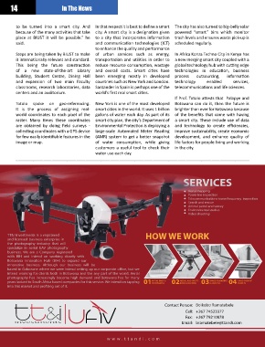
SERVICES
Aerial mapping
Powerline inspection
Telecommunications tower frequency inspection
Search and rescue
Animal patrol and survey
Environmental studies
Video shooting
TT&I Investments is a registered HOW WE WORK
and licensed business enterprise in
the photography industry that will
specialize in aerial UAV photography
business. We are a Company registered
with BIH and intend on working closely with
Botswana Innovation Hub (BIH) to expand our
innovative business. Although our business will be
based in Gaborone where we were intend setting up our corporate oce, but we
intend working for clients both in Botswana and the any part of the world. Aerial
photography has increasingly become high demand and Botswana has for many
IMAGE RENDERING
INITIAL BRIEF &
HAND OVER OF
years looked to South Africa based companies for this service. We intend on tapping 01PERMISSIONS 02 BRIEF & MAPPING 03 & ANALYSIS 04 RESULTS
AERIAL AND ONSITE
into this market and proting out of it.
Contact Person: Boikobo Ramatebele
Cell: +267 74523377
Fax: +267 79210878
investments Email: bramatebele@ttandi.com
w w w .ttandi.c om
Issue 26 Feb-Mar 2020 www.engineermagazine.co.bw